Curvas IDF Chile
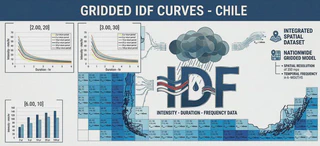 My Caption
Context and motivation
Extreme precipitation events are expected to intensify under global warming, particularly at sub-daily time scales, increasing the risk of flash floods and infrastructure failure. Reliable estimation of these extremes is therefore essential for hydraulic design, urban drainage planning, and flood risk management. Intensity–Duration–Frequency (IDF) curves remain the standard engineering tool for quantifying the relationship between rainfall intensity, duration, and frequency of occurrence.
Traditionally, IDF curves have been derived from rain gauge observations under the assumption of stationarity and often based on relatively short sub-daily records. These limitations can lead to biased estimates of extreme rainfall, particularly in regions with sparse monitoring networks, complex topography, or strong climatic variability. Moreover, ongoing climate change challenges the validity of stationary assumptions commonly used in engineering practice.
Recent advances in gridded precipitation datasets provide spatially continuous and temporally consistent information that complements conventional observations and improves the representation of precipitation extremes. Integrating these datasets with modern statistical approaches enables the development of more robust and spatially consistent IDF estimates, particularly in countries such as Chile, where climatic gradients and terrain complexity strongly influence rainfall patterns.
To operationalise these advances, the curvasIDF web platform was developed by the former student Cristóbal Soto Escobar and I with the support of the Water Resources Observatory of the Araucanía Region Kimün-Ko and the Center for Climate and Resilience Research (CR2), by providing standardised, nationally consistent estimates of extreme rainfall across continental Chile. By combining multiple datasets and updated statistical methodologies within an accessible web environment, the platform supports evidence-based infrastructure design and risk assessment under evolving climatic conditions.
Description
curvasIDF is a web platform designed to support the computation and visualization of Intensity–Duration–Frequency (IDF) curves across continental Chile. The platform integrates modern datasets and statistical methodologies to provide robust estimates of extreme precipitation across diverse climatic and topographic regions, including areas with limited observational coverage.
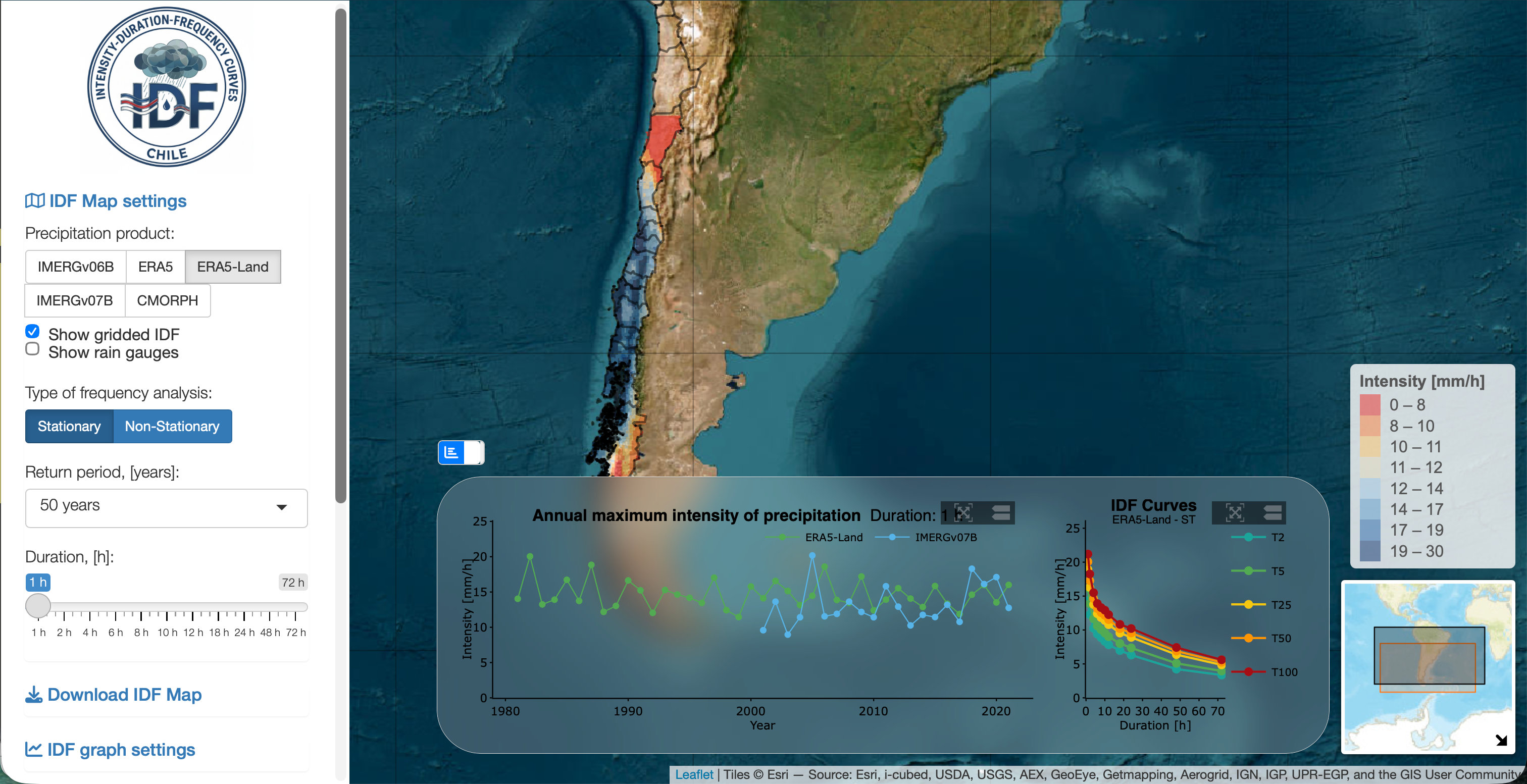
Main screen of curvasIDF web platform
By delivering nation-wide, spatially consistent IDF information, the platform supports infrastructure design, flood risk assessment, urban drainage planning, and climate resilience studies. It also promotes transparent and reproducible analyses, reducing the technical burden traditionally associated with extreme value modeling and facilitating the practical use of advanced statistical methods in engineering and applied hydrology.
Curvas IDF functionality
curvasIDF provides a set of operational tools designed to support engineering design, hydrological analysis, and climate risk evaluation.
Core capabilities include:
-
Computation of IDF curves for any location in continental Chile using statistically consistent methodologies.
-
Interactive visualization of rainfall intensity estimates for multiple durations and return periods.
-
Implementation of stationary and non-stationary statistical models, enabling users to evaluate the potential influence of changing climatic conditions on extreme precipitation.
-
Access to annual maximum precipitation intensities (Imax) derived from both gridded datasets and in-situ rain gauge observations.
-
Spatial exploration of extreme rainfall patterns, facilitating comparison of intensity values across regions with contrasting climates and topography.
-
Download of computed intensity values and associated parameters for use in engineering design studies, hydrological modeling, and risk assessments.
These functionalities streamline workflows that traditionally required specialized statistical expertise and extensive data processing, thereby broadening access to reliable extreme rainfall information for both technical and operational users.
Methodological framework
The methodology implemented in curvasIDF is fully documented in a 2026 scientific article published in the journal Hydrology and Earth System Sciences. This study represents one of the most comprehensive national-scale analyses of precipitation extremes in Chile, combining multiple gridded datasets with quality-controlled rain gauge observations to characterize rainfall intensity under both stationary and non-stationary climate assumptions.
The platform is based on a rigorous statistical framework that integrates observational and model-derived precipitation data to estimate extreme rainfall intensities across the country. Annual maximum precipitation intensities are computed using both stationary and non-stationary Gumbel probability distributions, covering the range of durations and return periods commonly required in hydrological and hydraulic design.
The analysis incorporates:
-
Five high-resolution hourly gridded precipitation datasets, representing different methodological approaches to precipitation estimation.
-
More than 160 quality-controlled rain gauge stations, providing reference observations for validation and bias correction.
-
Bias-adjusted precipitation intensities, ensuring consistency between gridded and in-situ estimates.
-
Trend detection techniques, including the modified Mann–Kendall test, to evaluate long-term changes in extreme rainfall behavior.
The resulting intensity estimates are calculated for durations ranging from 1 to 72 hours and for return periods between 2 and 100 years, covering the range typically required for hydraulic and hydrologic design standards. This integrated methodology captures regional differences in precipitation extremes and reflects the strong spatial variability associated with Chile’s climatic and topographic diversity.
Data sources
curvasIDF combines information from both observational and gridded precipitation datasets to ensure broad spatial coverage and statistical robustness.
Gridded precipitation datasets
- IMERG v06B
- IMERG v07B
- ERA5
- ERA5-Land
- CMORPH-CDR
In-situ observations
Hourly precipitation records from quality-controlled rain gauge stations distributed across continental Chile.
These complementary datasets enable reliable estimation of extreme rainfall intensities in both data-rich and data-sparse regions, improving the spatial consistency and practical applicability of IDF curves nationwide.
Relevance and applications
Reliable estimates of extreme precipitation are essential for the safe design and operation of critical infrastructure. The Curvas IDF platform provides a standardized, transparent, and nationally consistent reference for evaluating rainfall extremes in Chile, particularly in the context of increasing climate variability and the prolonged drought conditions observed since 2010.
By integrating advanced statistical methods, multiple data sources, and an accessible web interface, the platform supports evidence-based decision-making in:
- Hydraulic and hydrologic engineering design
- Flood risk and hazard assessment
- Urban stormwater management
- Climate adaptation planning
- Environmental and infrastructure resilience studies
In operational terms, the platform transforms complex statistical analyses into accessible, decision-ready information that can be directly applied in engineering practice, scientific research, and public-sector planning.
Reference
- Soto-Escobar, C., Zambrano-Bigiarini, M., Tolorza, V., & Garreaud, R. (2026). Developing Intensity-Duration-Frequency (IDF) curves using sub-daily gridded and in situ datasets: characterising precipitation extremes in a drying climate. Hydrology and Earth System Sciences, 30(1), 91–117. https://doi.org/10.5194/hess-30-91-2026.

I am an Associate Professor in the Department of Civil Engineering at the University of La Frontera. I hold a PhD in Environmental Engineering from the University of Trento (Italy) and completed postdoctoral training at the European Commission’s Joint Research Centre. I have more than 20 years of experience in water resources research and have previously served as an Associate Researcher at the Center for Climate and Resilience Research (CR)2 and as a member of the Earth Sciences Assessment Group of the Chilean National Research and Development Agency (ANID).
My research lies at the interface of hydrology, data science, and environmental sciences, with a particular focus on the use of gridded datasets and open-source tools to investigate droughts, extreme events, and water-related impacts of global change.
I work across spatial and temporal scales to improve the understanding of catchment-scale hydrological processes and to translate this knowledge into operational modelling, forecasting, and early-warning systems that support robust environmental decision-making.
Please reach out to collaborate 😃